Igor V. Zhurbina,#
a Udmurt Federal Research Centre, Ural Branch of RAS, Izhevsk, Russia
#E-mail: zhurbin@udm.ru
Keywords: settlement, plowing, preservation of the cultural layer, boundaries, the Polom and Cheptsa cultures, geophysics, multizonal survey, segmentation.
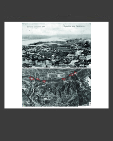
The paper proposes a new methodological approach to reconstruct the boundaries and structure of medieval settlements without relief features. Initially, a statistical analysis of multispectral aerial photography data is conducted including the calculation of Haralick textural features; the reduction in the number of features by principal component analysis; and the segmentation of images based on the obtained features using the k-means method. This analysis makes it possible to divide the settlement site and its vicinity into areas with fundamentally different vegetation intensities. A comparison with the geophysical and archaeological survey data allows the interpretation of the identified areas. The research was conducted at the fortified settlement of Sadeykar, the preliminary examination of which yielded a representative set of reference data. This made it possible to confirm the presence of defensive structures, to determine the boundary of the settlement, and to substantiate its row layout. The statistical analysis resulted in identifying the locations of occupation layer segments in different states of preservation and substantiating the settlement boundaries.
DOI: 10.31857/S0869606322040195


